- News |
-
- Featured
-
Canada’s privacy commissioner launches investigation over the use..
As the years pass by, technology also widens, and more and more are being discovered. From simple gadgets..
- Business |
-
- Featured
-
Be an informer to I-T dept; earn up..
Sharing "specific information" with the income tax department about any benami..
- Tech & Industry |
-
- Featured
-
Gravitational wave event likely signaled birth of black..
The merger of two neutron stars that generated gravitational waves detected last year may have led to the birth..

- Entertainment |
-
- Topics
- Malayalam Film
- Media
- Music
- Youth
-
- Featured
-
Shawn Mendes Released Highly Anticipated Self-Titled Album Today
Los Angeles, CA : Multi-Platinum singer/songwriter Shawn Mendes released his highly anticipated self-titled third album today, via Island Records. Get..

-
- New Products |
-
- Topics
- General
-
- Featured
-
ZOTAC Introduces Its GeForce GTX 960 series graphics..
Dubai- ZOTAC International, a leading innovator and manufacturer of graphic cards and mini-

-
- Education |
-
- Topics
- Campus News
-
- Featured
-
ITM University, Gurgaon Student Palash Chhabra Represents Varsity..
New Delhi: Palash Chhabra, a student of ITM University,..

-
- Health |
-
- Topics
- Medical News
-
- Featured
-
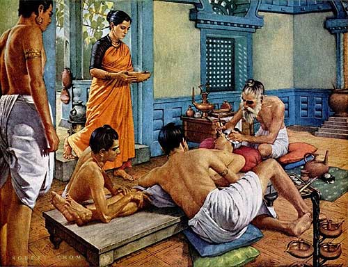
Maharshi Shushruta, The Great Grandfather of Surgery!
by Ayurvedacharya Dr.Hitesh Jani Dr.Hitesh Jani
-
- Tourism |
-
- Topics
- Travel
- Food&Beverages
- Hospitality
-
- Featured
-
“Keraliya Ayurveda is Credible and Authentic”
Irina Gurjeva Irina Gurjeva is not just another vacationer in..

-
- Sports |
- Editor's column |
- Magazine |
Leveraging Geospatial technology to effectively map the spread of COVID-19& minimize its impact on business
Published on May 25, 2020
New Delhi/Goa: The spread of Covid-19 and lockdowns imposed across the country has impacted government, large corporations, and SMBs alike. The numbers across industries like manufacturing, travel and tourism, agriculture, retail, and even e-commerce have shown a downward trend since March-20. As businesses are planning to come back stronger, geo-spatial technology to map Covid19 density zones can help them in planning their business operations. By providing accurate mapping of COVID19 cases and containment zones, ‘Transerve Technologies’ through its offering ‘Transerve Online Stack (TOS)’ is tracking, monitoring, analyzing and  visually representing geo-spatial data and helping organizations take statistically driven smart business decisions.
With Coronavirus spreading at a rapid pace, the need of the hour is to track the rate of spread of COVID-19 infections across geographies while alerting the uninfected about the proximity of such patients. Interactive Maps, which is a very important feature of TOS has become one of the most powerful tools to track, monitor and provide effective datasets on Novel coronavirus cases.
Large and medium-sized retailers who are now eagerly waiting to re-open their stores are heavily dependent on geo-spatial datasets on deciding which outlets to open and which ones to not open. Similarly, large manufacturing companies are using geospatial data to analyze their suppliers’ catchment areas and effectively plan their sourcing strategies. Supply chain professionals across organizations and logistics companies are planning to extensively use geospatial data for the route optimization of their vehicles by avoiding the red zones. Moreover, analyzing data of existing health infrastructure and census data sets and mapping it to those infected can help policymakers and concerned authorities in identifying COVID19 containment zones. Similarly, such analysis can also estimate the load on each corona testing center and help health officials to set up more labs or increase or decrease the capacity of existing ones depending on population density and distance to the testing laboratory. With so many practical applications TOS is emerging to be a very effective tool for governments and corporates. TOS has been maintaining a Corona timeline and created interactive digital maps of all the districts in India, and color-coded them to map all the Covid19 related information.
Commenting on how ‘Transerve Online Stack’ works, Mr. Amarsh Chaturvedi, Co-Founder, Transerve, and IIT-Kanpur alumnus said, “Keeping a tap on COVID19 contaminated zone is the need of the hour. Our Government is playing best on their part to keep the citizens safe from infection. It is very important for new-age entities like ours to support the Government and corporations by making the utmost use of our technology in order to deal with this global crisis. Transerve’s technologically advanced API based spatial platform serves as a single point database to access all the information related to COVID19 contaminated zones.
Mr. Ashwani Rawat, Co-Founder, Transerve and IIT-Kanpur alumnus said“With our platform, we aim at providing a helping hand to government authorities and corporates, so that the society can reap benefits on a larger scale. We are also publishing map visualizations on COVID19 related data released by Government sources from time-to-time in order to help the public in understanding the infection and its containment. The Maps published will be freely available for use by any organization globally.”
Transerve platform allows users to perform analysis on the web on real-time through an intuitive process and save the results for later use. The platform provides the functionality to collect data using mobile devices, manage, analyze, and publish the geospatial data on the web in real-time.