- News |
-
- Featured
-
Canada’s privacy commissioner launches investigation over the use..
As the years pass by, technology also widens, and more and more are being discovered. From simple gadgets..
- Business |
-
- Featured
-
Be an informer to I-T dept; earn up..
Sharing "specific information" with the income tax department about any benami..
- Tech & Industry |
-
- Featured
-
Gravitational wave event likely signaled birth of black..
The merger of two neutron stars that generated gravitational waves detected last year may have led to the birth..

- Entertainment |
-
- Topics
- Malayalam Film
- Media
- Music
- Youth
-
- Featured
-
Shawn Mendes Released Highly Anticipated Self-Titled Album Today
Los Angeles, CA : Multi-Platinum singer/songwriter Shawn Mendes released his highly anticipated self-titled third album today, via Island Records. Get..

-
- New Products |
-
- Topics
- General
-
- Featured
-
ZOTAC Introduces Its GeForce GTX 960 series graphics..
Dubai- ZOTAC International, a leading innovator and manufacturer of graphic cards and mini-

-
- Education |
-
- Topics
- Campus News
-
- Featured
-
ITM University, Gurgaon Student Palash Chhabra Represents Varsity..
New Delhi: Palash Chhabra, a student of ITM University,..

-
- Health |
-
- Topics
- Medical News
-
- Featured
-
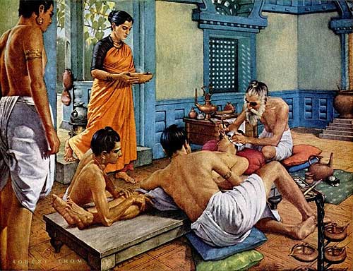
Maharshi Shushruta, The Great Grandfather of Surgery!
by Ayurvedacharya Dr.Hitesh Jani Dr.Hitesh Jani
-
- Tourism |
-
- Topics
- Travel
- Food&Beverages
- Hospitality
-
- Featured
-
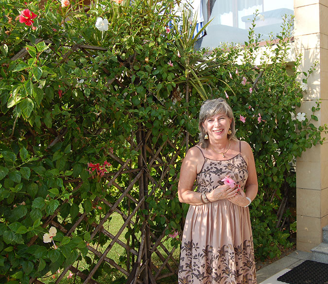
“Keraliya Ayurveda is Credible and Authentic”
Irina Gurjeva Irina Gurjeva is not just another vacationer in..
-
- Sports |
- Editor's column |
- Magazine |
Salt Lake City Selects Bentley’s WaterGEMS and HAMMER Software to Integrate Water Model and GIS
Published on December 15, 2010
United States: Bentley Systems, Incorporated, the leading company dedicated to providing comprehensive software solutions for the ![]() infrastructure that sustains our world, announced that Salt Lake City, Utah, has selected and deployed Bentley’s WaterGEMS V8i modeling and analysis software and HAMMER V8i transient analysis software to analyze, design, and operate its extensive water distribution system. The system serves approximately 450,000 residents and includes about 1,380 miles of pipes. Salt Lake City has a complete geographical information system (GIS) for its water, sewer, and stormwater infrastructure, for which each pipe in the various systems has been surveyed. The city’s goal was to create a hydraulic model of its water distribution system using its existing GIS so that it could maintain a one-to-one relationship between the two. Bentley’s WaterGEMS and HAMMER products enabled the city to easily accomplish this and also made the model building and updating processes easier and, thus, more efficient.
infrastructure that sustains our world, announced that Salt Lake City, Utah, has selected and deployed Bentley’s WaterGEMS V8i modeling and analysis software and HAMMER V8i transient analysis software to analyze, design, and operate its extensive water distribution system. The system serves approximately 450,000 residents and includes about 1,380 miles of pipes. Salt Lake City has a complete geographical information system (GIS) for its water, sewer, and stormwater infrastructure, for which each pipe in the various systems has been surveyed. The city’s goal was to create a hydraulic model of its water distribution system using its existing GIS so that it could maintain a one-to-one relationship between the two. Bentley’s WaterGEMS and HAMMER products enabled the city to easily accomplish this and also made the model building and updating processes easier and, thus, more efficient.
Brandon Arnold, GIS specialist at Salt Lake City Department of Public Utilities, said, “Our first priority when selecting our water modeling software was to make sure the water model could be integrated with our GIS and maintained or updated easily. The city chose Bentley’s WaterGEMS and HAMMER due to the software’s ease of use and full interoperability with Esri’s ArcGIS.”
The new water model was built from scratch using WaterGEMS and the city’s GIS. Once the pipe layout and connectivity were established, the software’s LoadBuilder and TRex tools, which are common to both applications, were used, respectively, to allocate water demand and elevations to the hydraulic model’s nodes. Pressure reducing valve (PRV) settings were imported from the GIS, and pump curves and controls were added.
Arnold continued, “WaterGEMS’ Network Navigator and Pressure Zone Manager were extremely helpful in picking out the small system details and locating the few errors that existed. With 55 zones modeled, which include more than 38,000 pipes, the Salt Lake City water system can be a little overwhelming at times. The Pressure Zone Manager was great for zone-by-zone analysis, and it also made model building much more efficient. Tracking down a missing closed valve sometimes can be tricky. With the Pressure Zone Manager, it is easy to tell where the zones are connected. Once the zones have been established, the data that the WaterGEMS model calculates and displays, including the boundary nodes and total flow into and out of the zones, is very helpful. Overall, the model building process was relatively simple.”
Now that the city has a working and up-to-date water model, its hydraulic analyses can include fire flow analysis, pipe sizing for new design projects, and some master planning. Many of the city’s ongoing projects rely heavily on the use of the WaterGEMS model. Future projects will be particularly challenging since model assumptions evolve as population grows, the distribution system expands, and the pipe infrastructure ages. For these reasons, both the GIS and water model need to be kept up to date.
As Arnold explained, “Keeping the GIS and hydraulic model synchronized is one of the biggest challenges, as we certainly want to avoid having to rebuild the water model from scratch every time the GIS is updated. The GIS-ID feature in WaterGEMS will be a big help in maintaining that relationship between the model and our up-to-date GIS. It is particularly handy to be able to split a pipe or add a valve in the model without altering the relationship to the GIS. It makes updating the model a cleaner and easier process.”